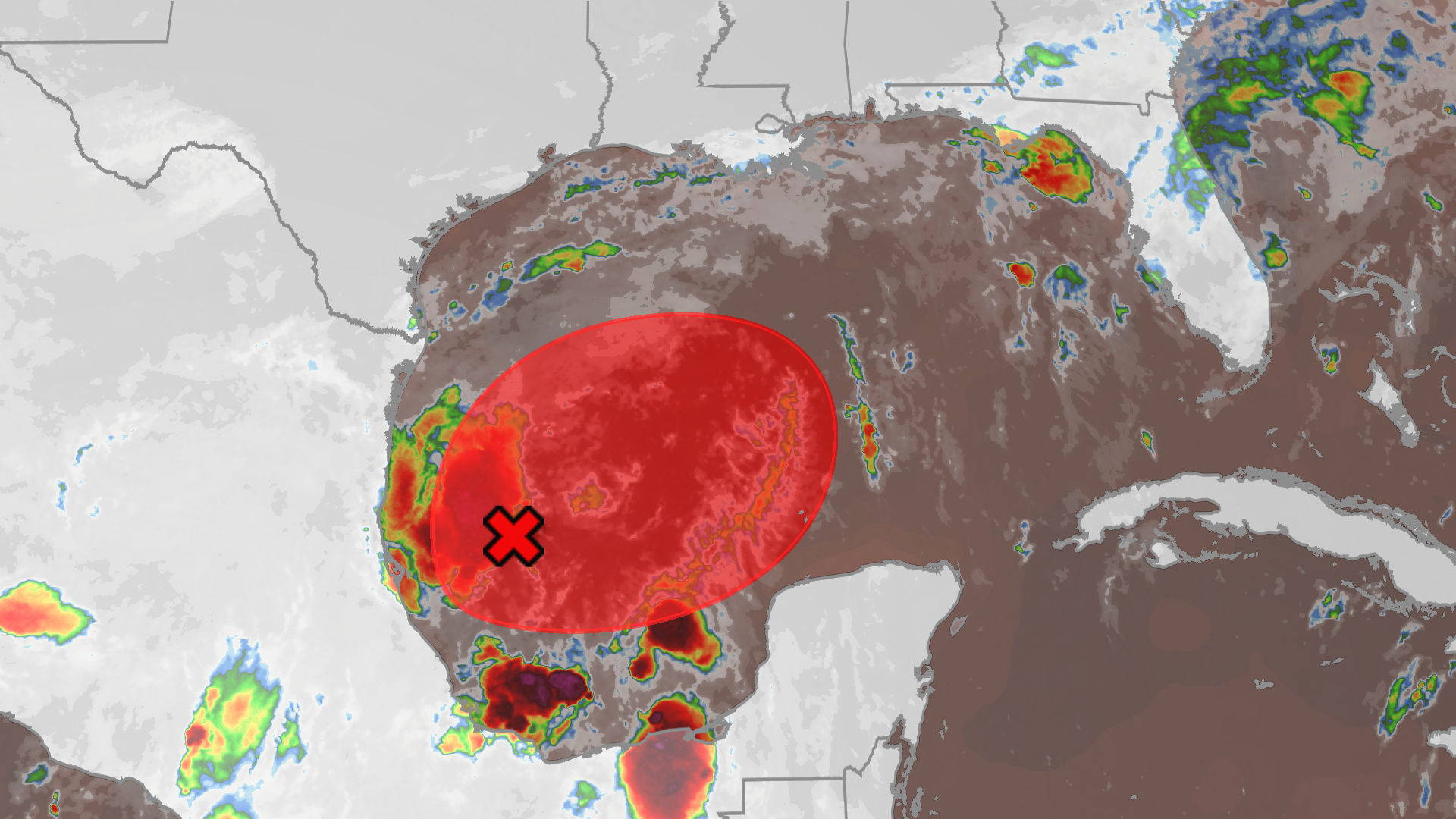
A new tropical threat is brewing in the southwestern Gulf of Mexico. The National Hurricane Center (NHC) has officially flagged an area of low pressure off the coast of eastern Mexico as Invest 92L, and is preparing to send hurricane hunters to investigate.
If the system develops sustained winds of at least 39 mph with a closed-off center, it will become Tropical Storm Isaias—the ninth named storm of the 2026 Atlantic hurricane season.
What is Happening in the Gulf?
Invest 92L is currently navigating an environment that is somewhat favorable for development over the next few days. The NHC has tentatively scheduled its first reconnaissance flight for Wednesday afternoon to gather critical data.
Meteorologists warn that even if the system does not reach official hurricane strength, it could still bring heavy rain, strong winds, and localized flooding to an already saturated Gulf Coast.
Projected Tracks and Timing
Forecast models currently show a wide range of potential paths, stretching from the upper Texas coast to the Florida Panhandle. However, recent model trends have begun shifting the storm's projected path closer to the Florida Panhandle.
Here is the general timeline of what to expect:
- Wednesday–Thursday: Potential formation of Tropical Storm Isaias.
- Friday: Rain chances begin to rise along the Gulf Coast.
- The Weekend: Widespread heavy rainfall is expected across the Southeast.
Because a sagging jet stream is creating strong wind shear in the northern Gulf, the storm will likely weaken as it approaches landfall. However, if the jet stream shifts north, a brief window of intensification could open up.
Why Quiet Seasons Can Still Be Dangerous
While a strong El Niño has made 2026 one of the quietest hurricane seasons in years, experts warn against complacency. It only takes one storm to cause catastrophic damage.
Earlier this season, three other systems overcame hostile El Niño conditions to strike the Gulf Coast:
- Tropical Storm Arthur (June): Dumped a staggering 37.53 inches of rain on Alexandria, Louisiana, making it the wettest Atlantic tropical cyclone on record.
- Tropical Storm Bertha (July): Struck Saint Bernard Parish, Louisiana, bringing widespread rainfall up to 5 inches.
- Tropical Storm Edouard (September): Made landfall with 60 mph winds and torrential rain.
With inland flooding and potential landslides on the table, residents from Texas to Florida should monitor local forecasts and ensure their emergency plans are ready.