What Happened
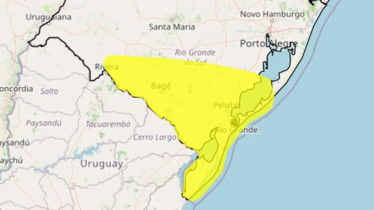
The National Institute of Meteorology (Inmet) has issued a yellow weather alert warning of potential storms across Rio Grande do Sul. The advisory went into effect at noon and remains active through late Friday night.
Forecasters predict rainfall reaching up to 50 millimeters, alongside strong, gusty winds and potential hail. The affected zone covers the southern half of the state, stretching from Santana do Livramento on the western border all the way down to the coastline near Mostardas. This sudden meteorological shift puts critical agricultural and urban centers on edge as unstable atmospheric pressure builds across the southern cone of Brazil.
Why It Matters
A yellow alert signifies a moderate risk weather event that carries the potential to become dangerous. Local authorities recommend staying informed through official channels and avoiding unnecessary exposure while the warning remains active.
This severe weather arrives amidst a sharp shift in regional temperatures. While the cold has temporarily receded, heat is building back up across the state, creating the atmospheric instability necessary for severe storms to form rapidly. Friday's forecast shows clear skies and highs reaching up to 32ºC in many areas before the severe weather front solidifies.
For local stakeholders—particularly farmers and municipal infrastructure managers—these sudden transitions between high heat and intense precipitation threaten crops, disrupt local transportation, and raise localized flood risks in vulnerable urban sectors.
What's Next for the Weekend
The unstable weather patterns will continue to evolve throughout the weekend. Saturday will start warm with temperatures once again hitting 32ºC, but conditions are expected to deteriorate rapidly between afternoon and evening as the main frontal system advances.
Heavy rainfall is projected to sweep across the West, Campanha, and Central regions, bringing accumulated totals between 20 and 60 millimeters, continued hail risks, and wind gusts exceeding 80 km/h capable of downing tree branches and disrupting power lines.
By Sunday, the precipitation will press further into the southern zones. Meanwhile, the northern and northwestern parts of the state will experience persisting intense heat, with maximum temperatures climbing as high as 35ºC. Residents and emergency management teams in the affected areas should monitor local meteorological updates closely as the situation develops.