What Happened
As summer fades, weather enthusiasts everywhere start asking the ultimate question: When will the first snowfall happen where I live?
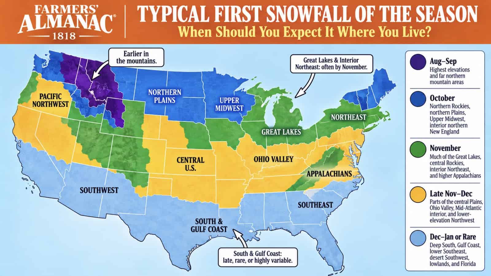
According to climatological data and maps from the Farmers’ Almanac, the first snowflakes of the season follow a relatively predictable geographic timeline across the United States. However, local geography, elevation, and sudden Arctic cold fronts can dramatically shift those dates up or down by weeks.
Regional Snow Timelines
The Lower 48 states generally fall into five distinct first-snowfall periods based on historical climate records:
- September: High-altitude mountain ranges, particularly in the northern Rockies, can see early snow flurries even before autumn officially begins.
- October: The northern Plains, Upper Midwest, and higher northern elevations experience their first measurable snow. Cities like Denver average their first snow around mid-October, though records show it can happen as early as September.
- November: Widely considered America's great first-snow month, November brings accumulating snow to the Great Lakes and interior Northeast.
- Late November & December: The central U.S., Ohio Valley, and Mid-Atlantic regions typically wait until late autumn or early winter.
- January & Beyond: The Deep South, Gulf Coast, and southern desert regions see rare or highly variable winter precipitation, often skipping measurable snow entirely in milder years.
Why It Matters
Meteorologists emphasize a critical distinction between different snow milestones: first flakes (which melt immediately), first measurable snowfall (at least 0.1 inch accumulating), and first significant snowfall (an inch or more requiring a shovel).
Understanding these thresholds prevents false alarms, especially in regions affected by lake-effect snow. Areas downwind of the Great Lakes—such as western New York and parts of Michigan—can experience intense, localized bands of early-season accumulation while neighboring towns remain completely bare.
What's Next
While historical averages provide a great baseline, experts remind residents that averages are not guarantees. Elevation, latitude, proximity to large bodies of water, and urban heat islands all influence whether a storm brings slush or a whiteout.
Ultimately, the first snowfall remains one of nature's most unpredictable seasonal transitions—arriving whenever the right mix of cold air and moisture finally aligns overhead.


