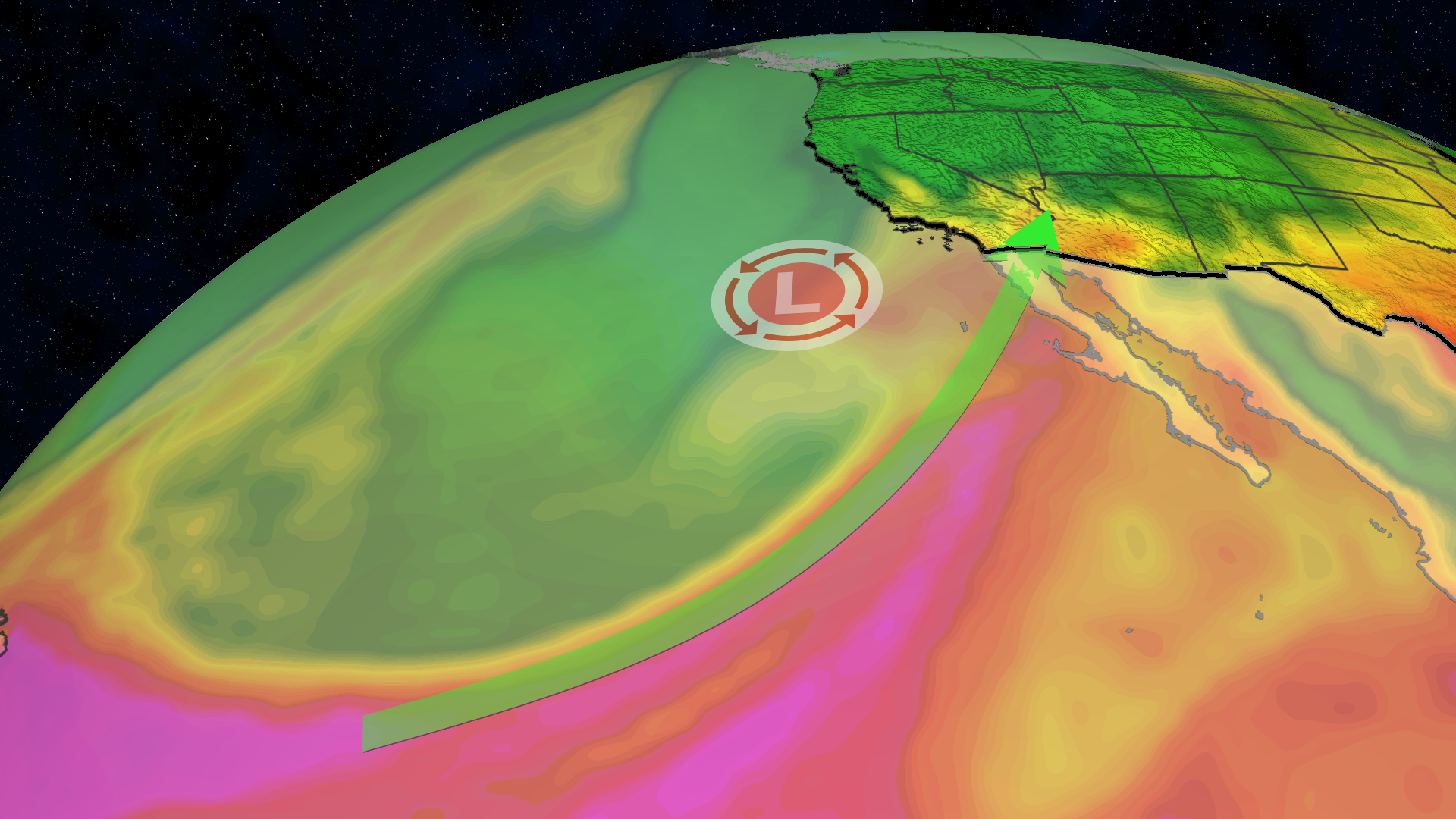
An atmospheric river affectionately known as the "Pineapple Express" is sweeping across Southern California and the Desert Southwest, threatening heavy rain and dangerous flash flooding over the weekend.
The storm comes just over a week after a previous system dumped 2 to 5 inches of rain across Arizona, Nevada, New Mexico, and Utah, leaving the ground completely saturated and ill-prepared for more precipitation.
What Happened
A steep southward plunge in the jet stream off the West Coast has tapped directly into a ribbon of warm, tropical moisture originating near Hawaii.
While meteorologists clarify that this specific Pineapple Express isn't the strongest on record, the volume of moisture it carries is unprecedented for this time of year. Atmospheric moisture levels across Arizona, Colorado, Nevada, and Utah are projected to reach two to three times the late-October average, pushing near-record levels for Halloween weekend.
Regions Facing the Highest Risk
As the low-pressure system moves onshore, heavy rainfall is spreading rapidly across the West.
- Extreme Flash Flood Risk: Flagstaff, Arizona, Zion National Park in Utah, pockets of northern New Mexico, and southern Colorado face the highest rainfall rates.
- Urban Centers: Heavy rain will impact the greater Phoenix area overnight, while Los Angeles and San Diego are also seeing light to moderate precipitation.
- High-Elevation Snow: Cold air in upper elevations will turn rain to snow over the higher peaks of the Sierra Nevada and the Rockies, creating hazardous, slippery travel conditions across mountain passes through Monday.
Why It Matters
The primary concern for meteorologists and local authorities is flash flooding. Rivers such as the Little Colorado and Verde in Arizona are forecast to run extremely high for days following the storm.
Search and rescue teams strongly advise canceling all weekend hiking plans in slot canyons and national parks across southern Utah, Arizona, and southern Colorado. Fast-moving runoff can turn dry washes into life-threatening torrents within minutes.
What's Next
This wet pattern may be a harbinger of what is to come this winter. Strong El Niño patterns typically fuel a significantly wetter Southwest from late autumn into spring. As jet stream patterns shift, residents across the region should prepare for an unusually active weather season ahead.


