A rapid atmospheric shift is bringing an early taste of winter across Western Canada, as a potent fall storm system sweeps through the Prairie provinces. Drivers across Alberta and neighboring regions may need to clear heavy snow off their windshields well before finishing their Halloween preparations.
A strong low-pressure system originating in the U.S. Rockies is dragging cold Arctic air into British Columbia, Alberta, and Saskatchewan. As this freezing air mass collides with warm, moisture-laden air lifting from the Pacific Ocean and the Gulf of Mexico, it is generating severe weather across all three Prairie provinces.
Inside the Low-Pressure System
The atmospheric collision is delivering a mix of gusty winds, driving rain, and intense snowfall. While southern regions will experience short, heavy squalls of wet snow that rapidly reduce visibility, the northern Prairies are bearing the brunt of the storm's total accumulation.
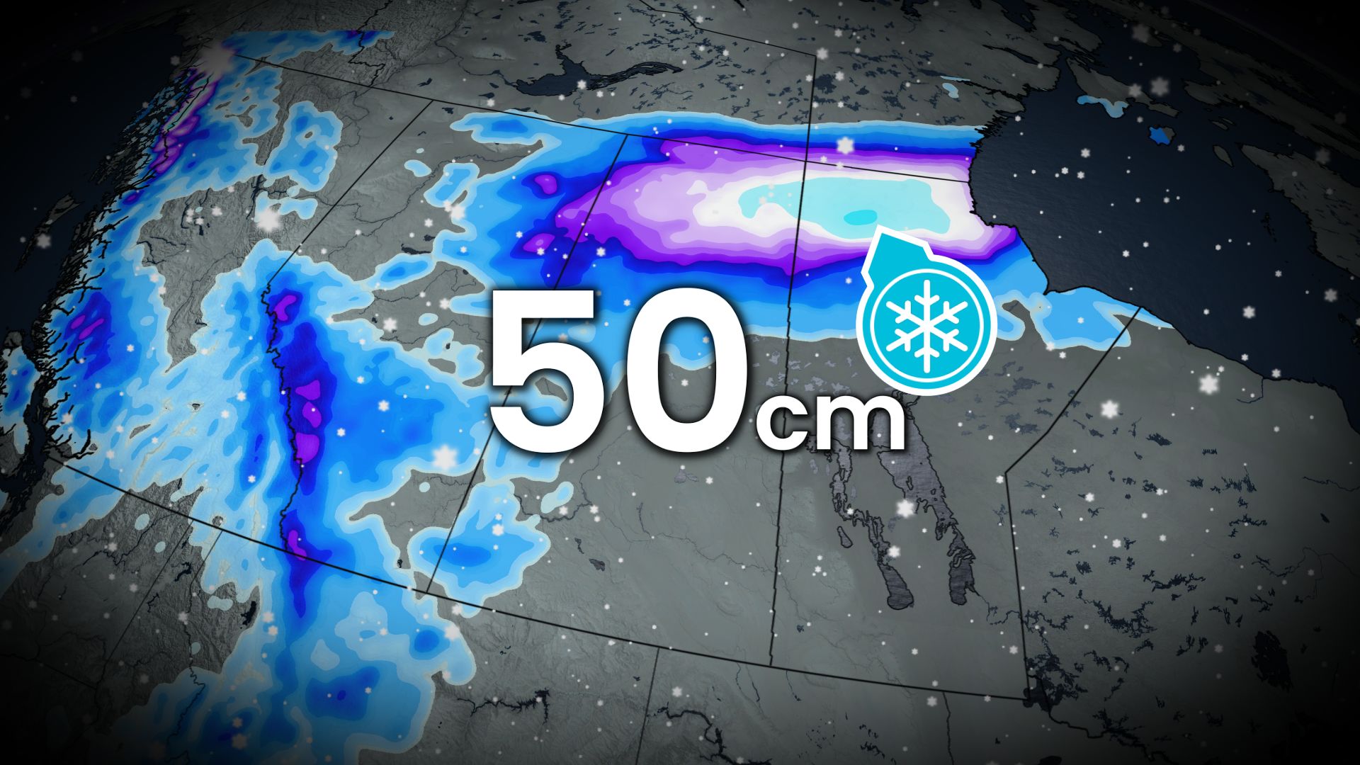
Parts of northern Saskatchewan and Manitoba are forecast to pick up 20 to 50+ centimeters of heavy snow by Friday night as the storm system lifts northward.
Heavy Impact on Friday Commutes
Commuters across Alberta face hazardous conditions as rain transitions to snow overnight into Friday morning.
Key regional corridors will feel the impact:
- The QE2 Corridor: Early Friday morning, wet snow combined with wind gusts reaching 50 to 60 km/h will create sudden slowdowns and low visibility between Edmonton and the U.S. border.
- Trans-Canada & Yellowhead Highways: Snowfall will move eastward by Friday afternoon, slicking major east-west travel routes.
- Fort McMurray & Border Areas: Blowing snow and sustained winds will lower visibility through Friday evening.
With many residents caught off-guard before making the seasonal switch to winter tires, officials advise drivers to reduce speeds, leave extra stopping distance, or delay unnecessary highway travel.
Weekend Outlook
The core of the storm system will shift northeast toward northern Saskatchewan and Manitoba by Friday evening. However, Alberta will not be completely in the clear.
A secondary disturbance on Saturday will push additional snow into the Canadian Rockies, adding to alpine totals. Flurries will likely drift over the Alberta foothills late Saturday evening, keeping temperatures cool and conditions wintery through the weekend.


